Saint Michael the Archangel Cemetery is a large Catholic cemetery in Palatine Township, Illinois, established by the Angel Guardian Orphan Society of Chicago. The cemetery was consecrated in 1958 and now covers 350 acres.
It began when the Angel Guardian Orphan Society of Chicago acquired three farms southeast of Roselle Road and Algonquin Road owned by the Porep, Fasse and Joy families in 1956. The Angel Guardian Orphan Society was a German Catholic organization founded in 1865.
Location
Saint Michael the Archangel Cemetery is located southeast of the intersection of Roselle Road and Algonquin Road in Palatine Township, Illinois. Its grounds occupy 350 acres and form one of the major cemetery sites associated with the area’s German Catholic history.
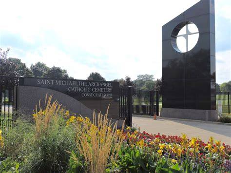
History of the cemetery
The Angel Guardian Orphan Society ran an orphanage at 2001 West Devon Avenue which relied on revenues from the operation of cemeteries. The Society’s acquisition of the three farms in 1956 created the foundation for the present cemetery.
The Cemetery was consecrated in 1958 and now covers 350 acres. Its establishment reflects the connection between Catholic charitable institutions, orphan-care organizations, and cemetery administration in the Chicago area.
Religious and community background
The Angel Guardian Orphan Society was a German Catholic organization founded in 1865. Its cemetery work formed part of a broader network of religious and community institutions that served Catholic families in the region.
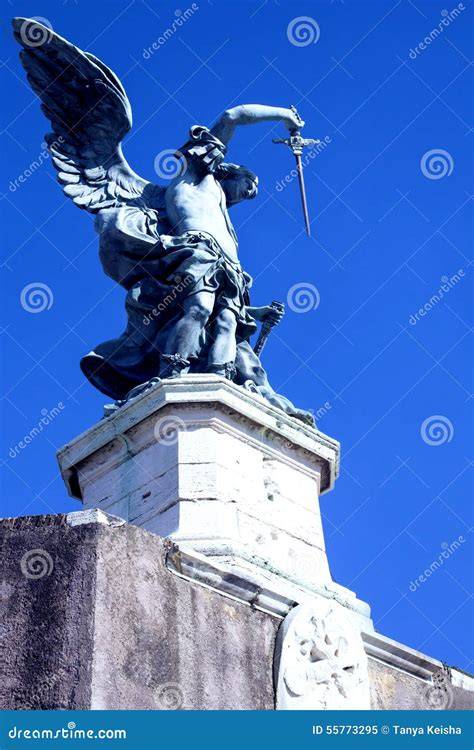
Saint Michael the Archangel is an important figure in Catholicism. Seen as a protector against evil here is a statue and mausoleum built more recently.
Burials and cemetery traditions
The cemetery was created as a Catholic burial ground and continues the tradition of consecrated burial associated with Saint Michael the Archangel. Its large acreage provides space for graves and other forms of interment developed within Catholic cemetery practice.
This is a mausoleum for cremated remains so Catholics that choose to be cremated can still rest on hallowed ground.
Two community mausoleums and private estates (family-owned mausoleums) offer the choice of entombment above ground. The Pieta, a beautiful statue of Mary cradling Our Lord, mourning his earthly death, crowns a granite columbarium where individuals can choose to have their cremated remains entombed.
Layout and memorial features
Spanning eighteen sections, the grounds are divided neatly into areas of traditional upright memorials, slant markers, and flush markers. Walking through the original sections of the cemetery, one is stuck by the beauty and craftsmanship of memorials that have lasted well over a century.
Masterfully carved angels and Saints oversee the consecrated ground so many have chosen as their final resting place over the years. The grounds sweeping 110 acres feature some of the most magnificent memorial stonework in Fairfield County, setting a serene environment for visitation and prayer.
The descriptions of upright memorials, slant markers, flush markers, community mausoleums, private estates, and a granite columbarium illustrate the range of memorial and burial forms found in Catholic cemetery landscapes.
Distinguishing Saint Michael cemeteries
The name Saint Michael or St. Michael is used by several cemeteries and historic burial grounds. Saint Michael the Archangel Cemetery in Palatine Township should not be confused with St. Michael’s Cemetery in Pensacola, Florida, or the historic St. Michael Cemetery in Stratford, Connecticut.
| Cemetery | Location | Historical information |
|---|---|---|
| Saint Michael the Archangel Cemetery | Southeast of Roselle Road and Algonquin Road, Palatine Township, Illinois | Established by the Angel Guardian Orphan Society; consecrated in 1958; covers 350 acres |
| St. Michael’s Cemetery | Pensacola, Florida | One of the two oldest extant cemeteries in the state of Florida |
| St. Michael Cemetery | Stratford, Connecticut | A resting place for residents of the greater Stratford/Bridgeport CT area since 1886 |
St. Michael’s Cemetery in Pensacola
St. Michael’s Cemetery, once a rural cemetery serving a colonial population, is today an eight- acre green space in the heart of urban, historic Pensacola, Florida. It is one of the two oldest extant cemeteries in the state of Florida (the other being Tolomato Cemetery in St. Augustine) and reflects the social history of the community it is associated with.
The cemetery is on the National Register of Historic Places as a contributing property to the Pensacola Historic District. Historical research and early maps indicate that the land in and around the modern cemetery was in use as a burying ground beginning in the mid to late 18th century.
The earliest surviving above ground markers in St. Michael’s Cemetery, however, are associated with Pensacola’s Second Spanish Period (1781-1821). The cemetery is an open-air museum that is a testament to the diverse history of Pensacola.
Pensacola drew immigrants from around the world. The cemetery is the resting place of Captains of Industry, victims of Yellow Fever epidemics and steam ship explosions, along with those who died in child birth, as infants, and of old age.
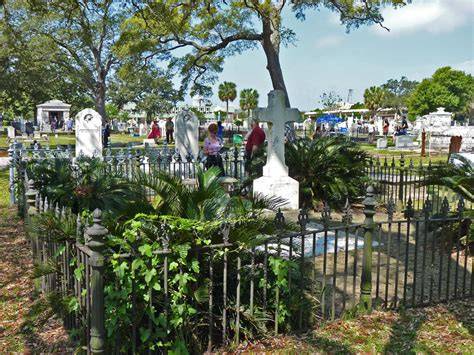
There are approximately 3200 marked graves in the cemetery with subsurface anomalies possibly several thousand unmarked graves. Tombstones in the cemetery reflect not only status and ethnicity of individuals but also reflect society as a whole on the Florida Gulf Coast frontier.
One has only to walk down the extant colonial road bed at the south end of the site to experience the strong sense of place and identity in the cemetery; a feeling of community.
Research and preservation in Pensacola
Today, primary stewardship for the cemetery is provided by St. Michael’s Cemetery Foundation of Pensacola, Inc. The nonprofit Foundation works with the University of West Florida and many community groups and individuals to preserve this historic site.
Research at historic St. Michael’s Cemetery is focused on expanding our knowledge of the history and physical development of our community. One project, The Search for the Hidden People of St. Michael’s Cemetery, identified unmarked burials at the site utilizing remote sensing techniques.
In-depth historical research focused on the burial patterns reflected in the Pensacola Bay area, individuals who lost their lives in Pensacola during the colonial period, and how the landscape of St. Michael’s evolved over time in relationship to the community it serves.
An in-depth history of the cemetery, results of the remote sensing survey, landscape reconstruction, and a colonial mortality database is now available. The ongoing research, conservation, and preservation efforts at St. Michael’s Cemetery are an excellent example of preserving our past to benefit our future.
St. Michael Cemetery in Stratford
The historic St. Michael Cemetery has been a resting place for residents of the greater Stratford/Bridgeport CT area since 1886. The grounds sweeping 110 acres feature some of the most magnificent memorial stonework in Fairfield County, setting a serene environment for visitation and prayer.
Walking through the original sections of the cemetery, one is stuck by the beauty and craftsmanship of memorials that have lasted well over a century. Masterfully carved angels and Saints oversee the consecrated ground so many have chosen as their final resting place over the years.
Spanning eighteen sections, the grounds are divided neatly into areas of traditional upright memorials, slant markers, and flush markers. Two community mausoleums and private estates (family-owned mausoleums) offer the choice of entombment above ground.
The Pieta, a beautiful statue of Mary cradling Our Lord, mourning his earthly death, crowns a granite columbarium where individuals can choose to have their cremated remains entombed.
Forest MAUSOLEUMS, Strange Abandoned Things and Historic Graves | Graveyard and Cemetery Exploration
Related cemetery history in Palatine Township
Saint Michael the Archangel Cemetery is part of a wider landscape of historic burial grounds in Palatine Township. The township’s cemetery history includes pioneer, church, township, and community cemeteries established at different stages of settlement.
Cady Cemetery
The cemetery began when Ezekiel and Adaline Cady buried their son, Wilbert, on a knoll behind the orchard on their farm in 1841. The Cadys and most of the early Deer Grove settlers had only been here a few years and there was no church building and no cemetery.
Other nearby settlers added the graves of their dead to Wilbert’s as time went on. In 1856, Ezekiel and Adaline Cady deeded the land the cemetery was on to the Palatine Township trustees and their successors.
Deer Grove Cemetery
Deer Grove Cemetery, also known as Salem Evangelical Cemetery, was the burial ground for the Salem Evangelical Church which once stood nearby. The church moved to Barrington in 1865 but still owns the cemetery and continues to make interments there.
Hillside Cemetery
Original Cemetery donated to the village by Joel Wood. The first 18 plots are to the left of the entrance gate and are a potter’s field, also known as a pauper’s field for unknown people or the poor who cannot afford a plot.
Most do not have stones or the exact location not known.
Mount Hope Cemetery
The United Evangelical Church was organized in 1848 and the original St. John’s church was built on the land donated by Morgan Johnson. In 1876, a new church was built on the same site and renamed St. John.
The cemetery directly east of the church building is the oldest part and people were buried chronologically as they died rather than in family plots. These stones are mostly in German and are eroded making them difficult to read; the oldest ones date from the 1850’s.
Prior to 1901 Mount Hope Cemetery was known as St. John’s Cemetery.
Salem Cemetery
The cemetery at Plum Grove and Kirchoff Roads began as an adjunct to the Salem Evangelical Church. The church was originally on the south side of Kirchoff Road at Plum Grove Road.
The church was built on land donated around 1862 by Frederick Thies and the cemetery was on the north side of Kirchoff Road. All services were in German.
In 1955, the congregation disbanded and the building was sold to the Lutheran church. The cemetery went into the hands of the Illinois Conference of the Evangelical United Brethren Church.
Sutherland Cemetery
This pioneer cemetery began on the farm of Silas and Lucinda Sutherland. It served as a burial ground for early settlers at the northeastern part of Palatine Township.
Silas Sutherland deeded the land to Cook County on June 10, 1863, for $1.00. The earliest known burial was in 1841.
By the mid-20th century the cemetery was in a state of neglect from fallen trees, brush, trash, animal burrows, and vandalism. In 1974, the Palatine Township Cemetery Committee began looking at our old pioneer cemeteries with the hope of restoring them.
Union Cemetery
Union Cemetery, southwest of Greeley Street and Washington Street, has also been called Southside Cemetery and German Cemetery. Its correct name results from the north half being reserved for Immanuel Lutheran Church and the south half for St. Paul’s Church.
Originally it was started by the Lutheran church. In 1882 H. C. Batterman donated additional land for the use of St. Paul’s Church.
In recent decades the condition of the cemetery deteriorated. In 1981 a cemetery association was formed and since then has been responsible for maintenance and operation.
Wolfrum Cemetery
Wolfrum or Old Plum Grove Cemetery is the oldest known cemetery in Palatine Township. It began in an unused corner of Orrin Ford’s farm where he settled in 1836.
When Ford sold his land circa 1856, he deeded the cemetery to Cook County. It has been called the Lost Cemetery because it was forgotten for many years.
Weeds and scrub brush grew over the stones and covered them from view. In 1975, the city of Rolling Meadows was laying a sewer line to serve a new development.